Free Snowmobile Trail Map: Prices & FCMQ Guide 2025-26
Quebec’s FCMQ manages over 30,000 km of snowmobile trails, and while a mandatory access pass costs money, the interactive trail map is free to use. Riders who know where to look can access real-time status updates, downloadable PDFs, and GPS navigation tools for the 2025-2026 season in regions like Gaspésie and Lac St Jean.
Season: 2025-2026 · Official Provider: FCMQ · Free Maps: Yes, interactive and downloads · Key Regions: Gaspésie, Lac St Jean · App: iMotoneige
Quick snapshot
- FCMQ provides interactive trail map at no cost (Pays de la motoneige)
- Trail status uses color coding: green means open, red means closed (Pays de la motoneige)
- Gaspésie alone offers more than 3,000 km of snowmobile trails (Tourisme Gaspésie)
- Exact permit pricing for 2025-2026 season pending official FCMQ release
- iMotoneige full cost structure not confirmed—app pricing has shifted historically
- Season 2025-2026 now active; some closures still in effect (Tourisme Gaspésie)
- Sainte-Madeleine-de-la-Rivière-Madeleine footbridge on Trail 5 remains closed this season (Tourisme Gaspésie)
- Permit sales likely open through FCMQ online shop and authorized retailers
- Trail status updates continue throughout winter season
Is snowmobile trail access free?
The short answer is: partially. An access pass—purchased through FCMQ—is mandatory for anyone riding on Quebec’s federated trail network, according to Tourisme Gaspésie. That pass isn’t free. What IS free, however, is the interactive trail map itself.
FCMQ notes that trail access rights through the federated network are not complimentary—the map’s free status does not extend to riding permissions. Riders must purchase an access pass to legally use the trails.
Free map options
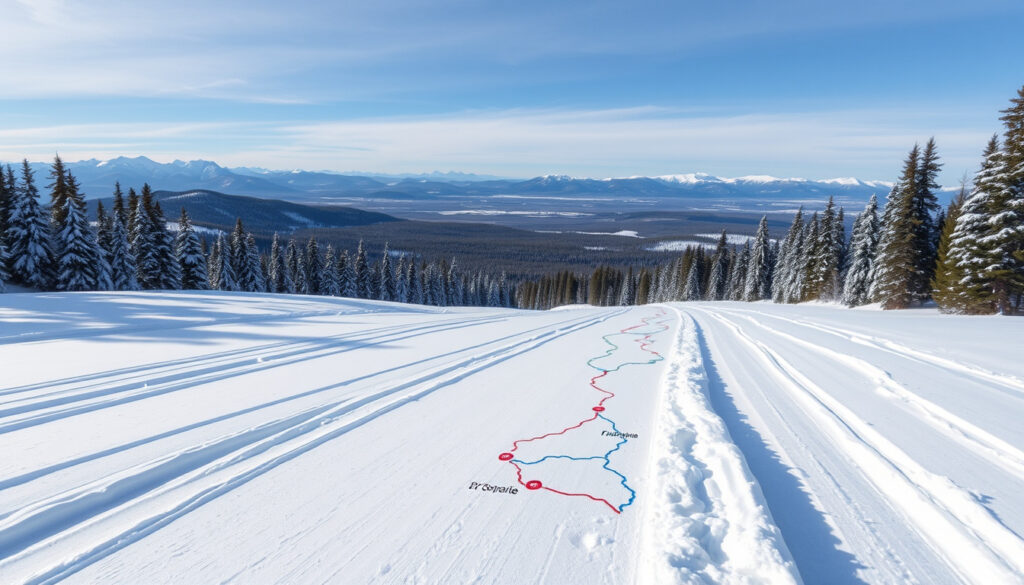
The FCMQ interactive map, available through Pays de la motoneige, requires no subscription to access on the web. Riders can view trail status in real time, identify open versus closed routes using a color-coded system (green for open, red for closed), and locate services like restaurants, accommodations, and gas stations marked directly on the map. The map also supports creating and sharing custom itineraries—a feature particularly useful for planning multi-day routes through regions like Gaspésie or Lac St Jean.
The map is free on desktop and mobile web, but the dedicated iMotoneige app charges $4.99 per year for full offline functionality and real-time GPS positioning.
Permit access rights
Access rights connect directly to the permit system. When riders purchase their FCMQ access pass, that payment funds trail maintenance, grooming, and the infrastructure behind the map updates. Pays de la motoneige notes that the trail network is updated in real time by FCMQ member clubs—so a closed trail on the map reflects an actual field condition, not a static database entry.
What is the price of a snowmobile trail permit for the 2025-2026 season?
Permit pricing for the current season has not yet been confirmed through official FCMQ channels at time of publication. Social media updates from FCMQ-affiliated groups have referenced upcoming tariff announcements for 2025-2026, but specific dollar amounts should be verified directly through the Pays de la motoneige shop or FCMQ’s official communications.
According to FCMQ-affiliated social media updates, tariff announcements for the 2025-2026 access rights are forthcoming—but official pricing had not been released as of publication.
Tariffs overview
Based on previous seasons, FCMQ access passes have typically ranged in the $150–$200 CAD range for the full season, with daily or weekend options available at reduced rates. Riders should check FCMQ’s online shop for the most current pricing structure, as rates can adjust annually to account for trail maintenance costs and operational expenses.
Permit revenue directly funds trail grooming and safety infrastructure. Skipping a legitimate pass isn’t a harmless shortcut—it puts the maintenance of 30,000+ km of trails at risk.
Seasonal rights
A standard season pass grants unlimited access to the entire FCMQ trail network for the defined season window, typically running from December through March or April depending on snow conditions. Day passes offer more limited access and are available through select retailers and potentially the FCMQ online portal.
Where to buy a snowmobile trail permit?
The primary purchase channel for FCMQ access passes is the organization’s official online shop, integrated with the Pays de la motoneige platform. Riders can also purchase through authorized retailers, which are listed on FCMQ’s regional partner pages.
Online purchase
The FCMQ online shop allows riders to purchase permits electronically, with the pass then linked to a rider profile that can be displayed on a mobile device or printed. This digital approach aligns with the interactive map’s functionality, creating a unified system where permit status and trail information are accessible from the same interface.
FCMQ options
Beyond the online shop, FCMQ maintains partnerships with regional snowmobile clubs and tourism associations across Quebec. These local partners often serve as permit sales points and can provide region-specific advice on trail conditions, recommended routes, and seasonal closures.
Here’s a breakdown of available purchase methods for FCMQ access passes:
| Purchase method | Availability | Notes |
|---|---|---|
| FCMQ online shop | Year-round | Direct from federation; full permit range |
| Authorized retailers | Varies by region | Check local club listings |
| Regional tourism offices | Peak season | Gaspesie, Lac St Jean, Mauricie hubs |
| iMotoneige in-app | Seasonal | Permit verification, not always purchase |
The implication: choosing the right purchase channel can affect how quickly you receive your permit and whether you have access to region-specific guidance from local club representatives.
How much does iMotoneige cost?
The iMotoneige mobile application costs $4.99 CAD per year for its premium features, according to Pays de la motoneige. This subscription includes offline map downloads and real-time GPS positioning—the two features that separate it from the free web-based map.
App features
iMotoneige overlays your current position onto the same trail map that powers the web version. For riders traveling through areas with spotty cell coverage—which includes much of Gaspésie’s interior—the offline download capability becomes essential rather than convenient. The app also pushes safety alerts directly to users when trail closures or hazardous conditions are reported.
Pricing updates
App pricing has evolved since iMotoneige’s launch, with subscription tiers and feature availability shifting over successive seasons. Riders relying on the app for navigation should verify current pricing before each season and check whether previously free features have moved behind the paywall.
Regional snowmobile trail maps and free options
Beyond the centralized FCMQ map, several Quebec regions publish their own trail resources—some free, some requiring registration or permit confirmation.
Gaspésie trails
Tourisme Gaspésie offers a dedicated snowmobile section with regional trail information, route suggestions, and closure notices. Gaspésie’s network spans more than 3,000 km, making it one of Quebec’s most extensive snowmobile destinations. The region is accessible via Highway 132, with trailheads positioned along the coast and inland routes connecting to the Chic-Choc Mountains.
The Sainte-Madeleine-de-la-Rivière-Madeleine footbridge on Trans-Québec Trail 5 is closed for the 2025-2026 season. Riders planning routes through that sector need to factor in the detour.
Lac St Jean maps
Saguenay Lac St Jean tourism publishes downloadable PDF maps and a regional trail viewer, available through the Pays de la motoneige platform. The region offers a mix of lakeside riding and forested interior routes, with Lac Saint-Jean itself providing a scenic anchor point for longer .
FCMQ interactive
The Pays de la motoneige interactive map serves as the umbrella tool, pulling trail data from FCMQ’s member clubs across all regions. Riders can filter by region, view trail status, search for points of interest, and build custom routes—then export those routes for use with the iMotoneige app or compatible GPS units.
Available mapping resources span free and paid options across Quebec regions:
| Resource | Provider | Cost | Best for |
|---|---|---|---|
| Interactive web map | FCMQ / Pays de la motoneige | Free | Real-time status, route planning |
| iMotoneige app | FCMQ | $4.99/year | Offline use, GPS tracking |
| Gaspésie PDF | Tourisme Gaspésie | Free | Regional overview, offline backup |
| Lac St Jean viewer | Saguenay Lac St Jean tourism | Free | Local routes, lodging access |
| Mauricie trail map | Regional FCMQ clubs | Free PDF | Distance planning, park connections |
| Season access pass | FCMQ | TBD for 2025-2026 | Legal trail access, network-wide |
Steps: How to access free snowmobile trail maps
Accessing the free interactive map and planning a route takes under five minutes if you know where to look.
- Navigate to Pays de la motoneige in any browser—no account required.
- Select your region from the map interface (Gaspesie, Lac St Jean, Mauricie, or full Quebec view).
- Toggle trail layers: open/closed status, points of interest, security alerts.
- Click any trail segment to view details including surface type, grooming schedule, and any active warnings.
- Use the itinerary builder to plot waypoints, then share the route or export for offline use.
- For offline mobile access, download the iMotoneige app and sync your saved routes ($4.99/year subscription).
- Before riding, confirm you hold a valid FCMQ access pass—display it digitally or carry a printed copy.
Related reading: Things to Do in Ontario: Top Attractions & Guides · National Sport of Canada – Lacrosse and Ice Hockey
fcmq.qc.ca, fcmq.qc.ca, tourismemauricie.com, valleematapedia.clubmotoneige.net, tourisme-gaspesie.com, bassaintlaurent.ca
Frequently asked questions
How to access the FCMQ interactive snowmobile trail map?
Go to Pays de la motoneige on any device. No login or subscription is required for the web version. The map loads with all trail segments visible, color-coded by status.
What regions offer free snowmobile trail maps?
The free interactive map covers the entire FCMQ network across Quebec. Regional tourism offices in Gaspésie, Lac St Jean, and Mauricie also publish free downloadable PDFs as supplementary resources.
Is there a free permit for indigenous snowmobilers?
Indigenous access policies vary by jurisdiction and community. Riders should contact the specific First Nations or Indigenous territory directly for their permit requirements, as these may differ from the standard FCMQ framework.
What updates are coming to iMotoneige?
FCMQ periodically updates the iMotoneige app with new features or pricing changes. Check the App Store or Google Play listing for the latest version notes, and follow FCMQ social channels for announcements.
How to plan a snowmobile trip using trail maps?
Start with the interactive map to identify open trails and services along your intended route. Build an itinerary with waypoints, check for closures along your path, then either reference the map on your phone or sync the route to the iMotoneige app for turn-by-turn navigation offline.
Are 2026 snowmobile trail permits available yet?
The 2025-2026 season is now active. Permits should be available through the FCMQ online shop and authorized retailers. Verify current pricing directly through FCMQ official channels before purchasing.
What devices support free snowmobile GPS maps?
The web-based interactive map works on any device with a browser—desktop, tablet, or smartphone. The iMotoneige app is available for iOS and Android. Some compatible GPS units can import routes exported from the interactive map.
Sources
- Pays de la motoneige (Official FCMQ trail platform)
- Tourisme Gaspésie (Regional snowmobile guide)
More related posts
 How to Make a Paper Airplane: Easy Steps That Fly Far
 2024 Stanley Cup Finals: Panthers Beat Oilers 4-3 in Game 7
 Cheap Flights: Calgary Intl Airport to Bud Airport
 What Is the Date Today MM-DD-YYYY – Live US Format Guide
 Sheraton Cavalier Calgary Hotel: Reviews, Parking, Pool & Prices
 Surging Sparks Card List – Full 191+ Cards and Secret Rares
 The Wiggles The Twelve Days of Christmas Lyrics – Full Lyrics and Album Guide
 Royal Canin Gastrointestinal Dog – 2025 Complete Guide